Hiking Route · Gaistal
Gehrenspitze
Start: Puitbach/Ahrn car park (P13), Leutasch
23.3
km
1360
m elev ↑
10 h
Duration
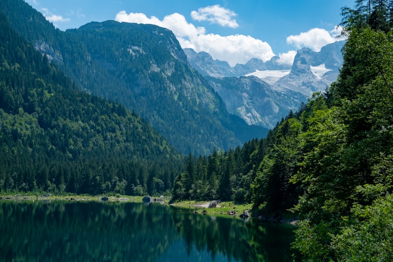
The Gehrenspitze at 2,367 m is the best-known and most beautiful summit in the direct vicinity of the Gaistal – and one of the most impressive hiking peaks in the Zugspitze region. Standing on the summit, you have the entire Gaistal spread out below you: you can see how the valley is nestled between the Wettersteingebirge and the Mieminger Kette, how the Gaistalbachbach flows silver through the valley floor and how the Zugspitze dominates the panorama to the north. This is the view that makes the 1,360 metres of elevation gain worthwhile.
The Summit
The Gehrenspitze (2,367 m) is not a technically demanding climbing peak – it is a hiking summit for experienced and fit mountain walkers. The route passes through alpine meadow terrain, over scree and rocky passages to the summit ridge. Sure-footedness is absolutely essential; climbing equipment is not required.
The summit panorama encompasses:
- North: Zugspitze (2,962 m), Wettersteinmassiv
- East: Karwendelgebirge and Inn valley
- South: Mieminger Kette, Tiroler Zugspitzarena
- West: Ammergauer Alpen extending far into Bavaria
Route Description
Start at Puitbach/Ahrn car park (P13): The starting point is in Leutasch, near the hamlet of Ahrn. From the car park, follow the marked trail, initially ascending on gentler terrain.
Ascent through alpine meadow terrain (approx. 1.5 hrs.): The first section leads through typical Leutasch alpine pasture – open grassy slopes, scattered dwarf pines, increasingly fine views into the valley. The terrain is still uncomplicated.
Wangalm (1,750 m, approx. 2 hrs.): Many Gehrenspitze tours pass via the Wangalm – a good intermediate stop for refreshments and rest. The actual summit ascent begins from the Wangalm.
Summit ascent (approx. 2 hrs.): From the Wangalm towards the Gehrenspitze – the terrain becomes rockier and more demanding. Rocky slabs, scree and narrow paths alternate. The final 200 m before the summit are the steepest – this is where sure-footedness matters most.
Gehrenspitze summit (2,367 m): The summit cross is a landmark visible from far below in the Gaistal. Those who reach it have one of the finest views in the region before them. Plan time to rest and take it all in.
Descent: Same route back (approx. 2.5 hrs.) or a variant via the Wettersteinhütte (slightly longer, but with a refreshment stop).
Alternative Approach via the Gaistal
Those starting from the Gaistal can approach the Gehrenspitze via the direct ascent from the Wettersteinhütte:
- Start: Stupfer car park (P2), Gaistal
- Route: Via Wangalm and Wettersteinhütte (1,717 m, currently unstaffed) to the Gehrenspitze
- Advantage: Greater altitude already gained at the start of the actual summit tour
- Disadvantage: Greater total distance
Requirements and Equipment
The Gehrenspitze is a Difficult tour:
- Experienced walkers with mountain experience
- Sure-footedness and a head for heights
- Mountain boots (not trail shoes)
- Trekking poles recommended
- 2.5 litres of water (no water source in the upper section)
- Waterproof jacket and warm layer
- Early start (off the summit by midday at the latest)
Dogs: Not suitable or recommended on the rocky summit terrain.
Safety Notes
- Thunderstorms: Common in summer from 1–2 pm onwards – the summit must be left by noon
- Wet rock: Extremely slippery in rain – do not attempt the tour in or after rain
- Fall hazard: Steep terrain with fall potential in the upper section – only for those with sure footing
Tips for the Tour
- Planning ahead: Factor in the Wettersteinhütte as a stop on the way up or down – the best refreshment option
- Sunrise: To catch the sunrise on the summit – plan an overnight stay at the Wettersteinhütte and set off at 3 a.m.
- Best time to go: August–September for the best weather and reduced risk of thunderstorms
The Gehrenspitze is the most alpine destination in the direct Gaistal surroundings – for all those prepared to invest the necessary fitness for the finest panorama.
Route map
Frequently asked questions about Gehrenspitze
- How difficult is Gehrenspitze?
- Gehrenspitze is rated Hard. The route is 23.3 km long. Elevation gain: 1360 m.
- How long does Gehrenspitze take?
- The tour takes approximately 10 h.
- Are dogs allowed on the Gehrenspitze route?
- Dogs are not allowed on this route or please enquire beforehand.
- Is Gehrenspitze family-friendly?
- This route is better suited to more experienced hikers.
Questions about the route?
The AI guide knows all the details about this tour